Old Tory Fort
We entered the woods armed with a treasure map of sorts. Or rather, we had a professional surveyor’s map to guide us to our destination. The spot we were seeking was high on an unfrequented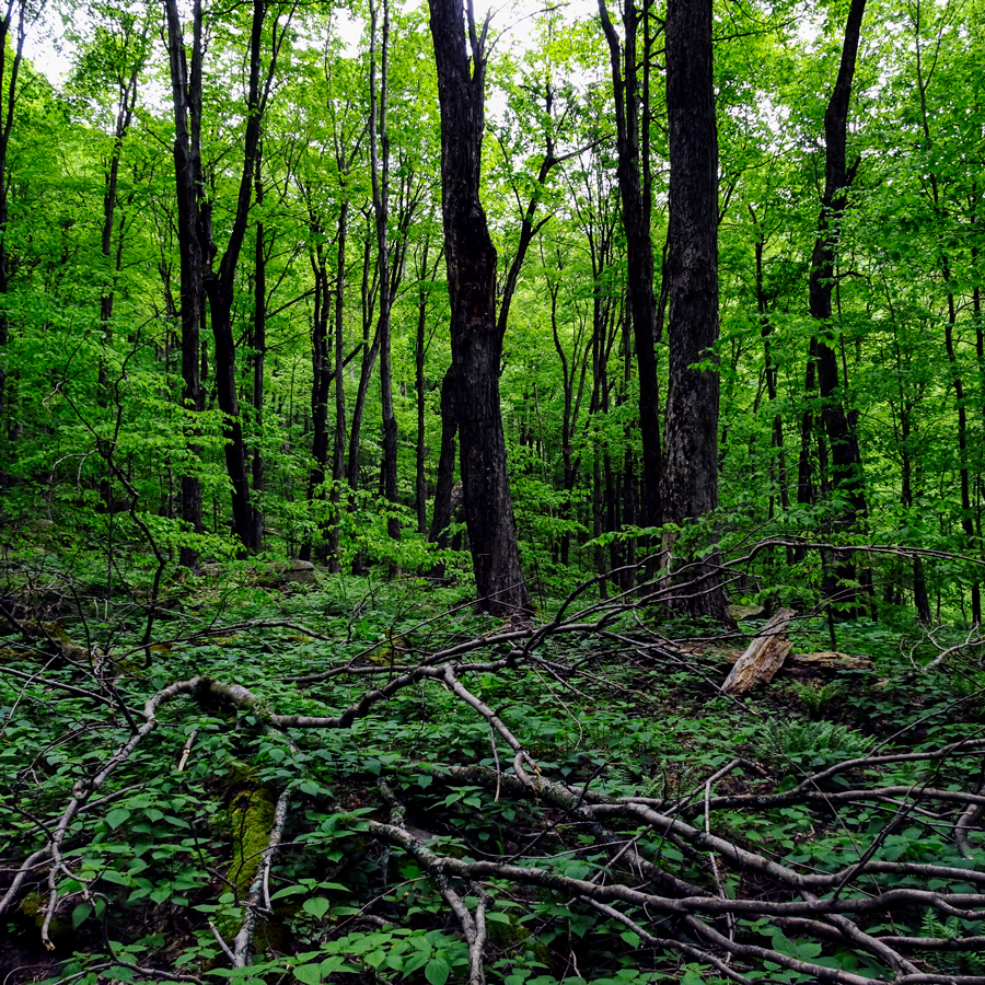 slope in the Catskill Mountains. It was marked not by an “X” but by a pair of small survey markers installed in nearby boulders by surveyor Ed West and his assistants. The map was the result of a Bicentennial Project to establish the exact location of the legendary “Old Tory Fort” in the recesses of the Kaaterskill High Peak Range. A note on the map provides a succinct description of the landmark’s historical importance: “The fort was used by the Indians and Tories under Joseph Brant, as a prisoner holding station on the way to Fort Niagara.” West’s survey work was conducted more than four decades ago. Apart from this, the historical record concerning Old Tory Fort is sketchy. No contemporaneous description of the compound from Revolutionary times has ever come to light. Local lore has always been the best source of information, but this comes filtered through the fancy of many generations. As so often happens in the “old air” of these mountains, facts become active. They begin to move around. They wander off. Next thing you know, they’re lost. Despite a reliable map, there is no telling what might be found at the site of Old Tory Fort.
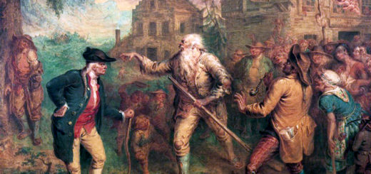
The American Revolution brought perilous times to the Hudson Valley. The Mohawk, Cayuga, and Seneca nations allied themselves with the British. A Mohawk military leader by the name of Joseph Brant, along with others, organized raiding parties that consisted of Indians and British Loyalists 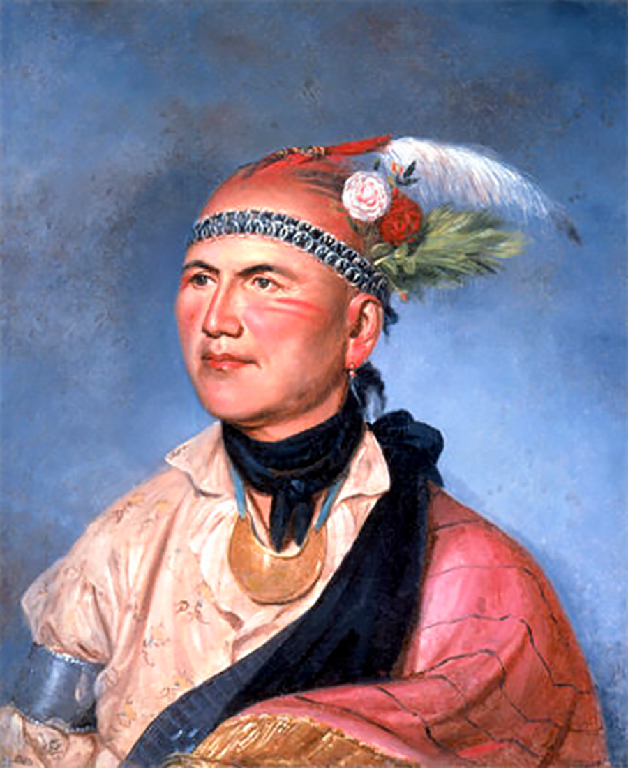 disguised as Indians. Their mission was to terrorize settlers in the valley who had revolutionary sympathies. More than a hundred years after the fact, the J.B. Beers History of Greene County describes the events that took place in the vicinity of Kaaterskill High Peak. “It is undisputed that this region was the rendezvous of many of those unscrupulous men termed tories, who acted as leaders and guides to the Indians in their expeditions to the more southern settlements for plundering, burning, taking captives and murdering, and who had supplies of provisions concealed in different parts of the forest.” These raiding parties would travel into the Catskills from the north and west along Schoharie Creek. They set up camps in the elevated wilds close to the eastern escarpment of the range, the so-called “Wall of Manitou.” The Beers description continues: “One of their most infamous rendezvous was situated high up on the side of the mountains northwest of the Plaaterkill, from which a view of a wide extent of country below could be had. At this spot they had built a small stone fort, partially against the steep grade of the mountain, around which was a log stockade, fronting what is now called Tory Swamp. The remains of this notorious structure are yet to be seen.” The historian concludes his account with these rousing words: “The atrocities of that unequal struggle are now but history; the Indian raider is no more; his trail has disappeared; his fort is but ruins; the disguised Britisher will no more assist at massacres, and glory in the success of his military strategy. ‘Time’s effacing fingers’ have softened down the asperities of that period. But let us, in visiting the site of this historic rendezvous, forget not the lesson its history teaches, and thank God for being a few steps removed from that period; and thank him not the less fervently for the glorious advance in our civilization.”
Our route to Old Tory Fort on Memorial Day 2018 began at a mute “witness tree” at the head of an old wood road. The tree had recently been blazed in red by surveyors from the New York City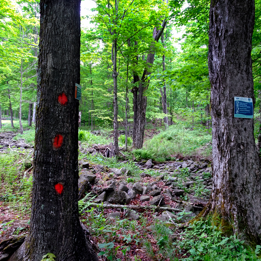 Department of Environmental Protection. Our party crossed Canda Creek and started climbing a hill. Along the way we passed several stone walls, former pasture boundaries now serving as touchstones of nostalgia for a pastoral paradise lost. Soon we came upon the site of a former saw mill, put into operation nearly a century ago. Back then, the surrounding forest—presumably all first growth—was clearcut and several hundred thousand boardfeet of lumber extracted. Scant evidence of clearcuts or mill remains. To the untrained eye, the towering maples, yellow birches, white pines, and dying hemlocks that stand here today constitute the forest primeval itself.
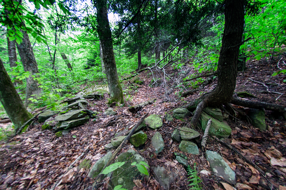
A little further along on the wood road, we came upon the nearly indiscernible traces of a logging railroad. This had been built to transport timber to the mill. When the cutting operations ceased, the rails were pulled up and the forest reclaimed its immemorial right of way. Near here we could make out the bright green interval of a former beaver pond turned meadow. Perhaps the dam was removed by Irene in 2011. We again crossed Canda Creek, now following it toward the source. Before long we entered upon the swampy ground of a sheltering hollow lush with patches of wild leeks, many already turning yellow. Lying on the ground here was a deflated, weather-ravaged mylar Happy Birthday balloon. Somebody picked it up and put it in a litter bag. Soon after that, a spent shotgun shell was spotted in the mud. This too was picked up and put in the litter bag. Then came a large, heavy green bottle leaning against the base of a stump. The neck of the bottle was broken and deemed too dangerous to carry. It was left where found. A few more minutes of picking and choosing what seemed to be the best way through the swamp brought us to the site of Old Tory Fort.
The place appeared exactly as described by a note on the West survey map: “The physical evidence at this time is a depression in the ground with remains of a stonewall or rampart on the easterly side. It is on the foot of a bank on the westerly bank of the northerly branch of the Schoharie Creek. At this point the stream flows along the westerly edge of the Tory Swamp.” The map indicates a maple standing in the middle of the fort. It’s still there. The map also shows a survey marker on a rock found 28.90 feet from the maple tree, and another survey marker in another rock 37.44 feet from the maple—both still there. One thing that had changed: the declination of Magnetic North, which today is nearly a half degree further west from True North than it was in 1976.
We sat down among the tumbled stones and leaf decay of centuries that today comprise Old Tory Fort and ate our lunch. Without the map and our heads full of history, we could find nothing about this spot that distinguished it from innumerable other such spots in the Catskill Forest Preserve. Talk about the effacing fingers of Mother Nature. We finished eating and took some pictures. Then we left the place as we found it.
©John P. O’Grady
Originally appeared in The Mountain Eagle on June 1, 2018